
Indian Geography – A Comprehensive Overview
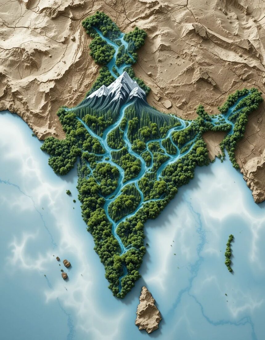
India is a land of vast diversity, not only in culture, languages, and traditions but also in its geography. Stretching from the snow-clad Himalayas in the north to the tropical shores of the Indian Ocean in the south, India’s geography plays a crucial role in shaping its history, economy, climate, and biodiversity.
1. Location and Extent
Continent: Asia
Position: Between latitudes 8°4’N and 37°6’N, and longitudes 68°7’E and 97°25’E
Total Area: 3.287 million sq. km (7th largest in the world)
Borders:
North & Northwest: Pakistan, China, Nepal, Bhutan
East: Bangladesh, Myanmar
South: Surrounded by the Indian Ocean (Arabian Sea to the southwest, Bay of Bengal to the southeast)
Coastline: About 7,516 km, including islands
2. Major Physiographic Divisions
India can be divided into six major physiographic regions:
A. The Northern Mountains
Formed by the Himalayas, the youngest and highest mountain range in the world.
Divided into:
Himadri (Greater Himalayas): Highest peaks like Mount Everest (in Nepal), Kanchenjunga (India’s highest).
Himanchal (Lesser Himalayas): Hill stations like Shimla, Mussoorie, Nainital.
Shiwaliks (Outer Himalayas): Foothills rich in biodiversity.
Significance: Acts as a climatic barrier, source of perennial rivers, home to glaciers.
B. The Northern Plains
Formed by the Indus, Ganga, and Brahmaputra river systems.
Very fertile due to alluvial soil.
Important for agriculture (rice, wheat, sugarcane).
Dense population centers like Delhi, Kolkata, Patna.
C. The Peninsular Plateau
Oldest landmass in India (part of Gondwana land).
Includes:
Central Highlands (Malwa Plateau, Bundelkhand, Chotanagpur Plateau – rich in minerals).
Deccan Plateau (bounded by Western & Eastern Ghats).
D. The Indian Desert
Thar Desert in Rajasthan.
Sandy, arid climate, sparse vegetation.
Dotted with dunes and receives less than 25 cm of rainfall annually.
E. The Coastal Plains
Western Coastal Plain: Narrow, rich in coconut and rice cultivation, has backwaters (Kerala).
Eastern Coastal Plain: Broader, fertile, deltaic regions of rivers like Godavari, Krishna, Mahanadi.
F. The Islands
Andaman & Nicobar Islands: Tropical rainforest, strategic location in Bay of Bengal.
Lakshadweep Islands: Coral atolls in the Arabian Sea.
3. Major Rivers
Himalayan Rivers: Ganga, Yamuna, Brahmaputra (perennial, fed by glaciers).
Peninsular Rivers: Godavari, Krishna, Mahanadi, Kaveri (seasonal, rain-fed).
Lifeline for agriculture, drinking water, transportation.
4. Climate
India’s climate is shaped by the Tropical Monsoon System:
Winter (Dec–Feb): Cool and dry.
Summer (Mar–May): Hot and dry.
Southwest Monsoon (Jun–Sep): Brings 75% of annual rainfall.
Retreating Monsoon (Oct–Nov): Northeast winds, rain in Tamil Nadu.
5. Natural Resources
Minerals: Coal (Jharkhand, Odisha), iron ore (Chhattisgarh, Karnataka), bauxite, mica.
Forests: Cover about 21% of India’s area, rich in teak, sal, sandalwood.
Biodiversity: Tigers, elephants, lions, rhinos, countless bird and reptile species.
6. Importance in Daily Life and Society
Food Security: Fertile plains sustain millions.
Culture: Geography influences regional cuisines, clothing, architecture.
Economy: Agriculture, mining, tourism depend on geography.
Defense: Himalayas act as a natural shield.
7. Fun Facts
India’s southernmost point is Indira Point (Nicobar Islands).
The Cherrapunji–Mawsynram region in Meghalaya is one of the wettest places on Earth.
The Sundarbans is the world’s largest mangrove forest.


