
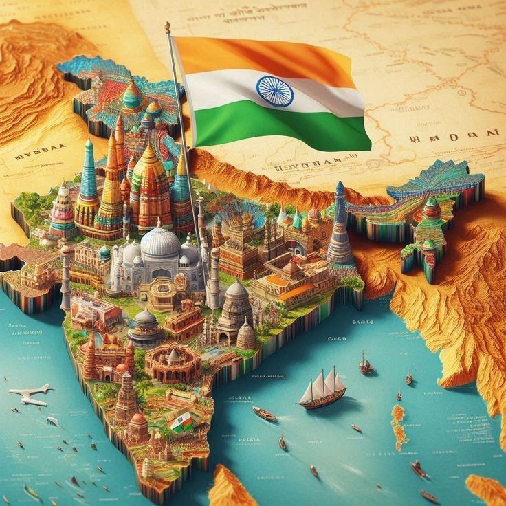
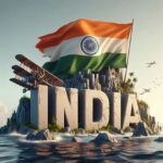
Geography of India – The Land of Diversity
India is often called a mini-world because of its incredible geographical diversity. From the snow-clad peaks of the Himalayas to the sun-kissed beaches of Kerala, from the vast Thar Desert to the lush green forests of the North-East, India’s geography is a tapestry woven with nature’s finest threads.
- Geography of India – The Land of Diversity
- 1. Location and Position
- 2. Major Physical Divisions of India
- A. The Himalayan Mountains
- B. The Northern Plains
- C. The Peninsular Plateau
- D. The Indian Desert
- E. The Coastal Plains
- F. The Islands
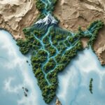
- 3. Major Rivers
- 4. Climate Zones
- 5. Flora and Fauna
- 6. Economic and Cultural Importance
- 7. Quick Facts
- 8. Daily Life Impact
- Conclusion
The country is located in South Asia, sharing borders with Pakistan, China, Nepal, Bhutan, Bangladesh, and Myanmar, and surrounded by the Indian Ocean, Arabian Sea, and Bay of Bengal. It’s the seventh-largest country in the world by area and the most populous country as of recent years.
1. Location and Position
Coordinates: Between 8°4′ N and 37°6′ N latitude, and 68°7′ E and 97°25′ E longitude.
Total Area: About 3.287 million square km.
Border Length: ~15,200 km of land borders.
Coastline Length: ~7,516 km.
Neighbouring Countries: Pakistan, Afghanistan (small border), China, Nepal, Bhutan, Bangladesh, Myanmar, and maritime borders with Sri Lanka and Maldives.
2. Major Physical Divisions of India
India’s geography can be divided into six major physical regions:
A. The Himalayan Mountains
Located in the north, forming a natural barrier.
Divided into:
Himadri (Greater Himalayas) – Highest peaks, like Mount Everest (in Nepal) and Kanchenjunga (8,586 m).
Himachal (Lesser Himalayas) – Famous hill stations like Shimla, Mussoorie.
Shiwalik (Outer Himalayas) – Foothills with valleys like the Doon Valley.
Importance:
Protects India from cold winds.
Source of major rivers like Ganga, Yamuna, and Brahmaputra.
B. The Northern Plains
Formed by the Indus, Ganga, and Brahmaputra river systems.
Extremely fertile — often called the “Granary of India”.
Covers states like Punjab, Haryana, Uttar Pradesh, Bihar, West Bengal, and Assam.
C. The Peninsular Plateau
One of the oldest landmasses on Earth.
Divided into:
Central Highlands
Deccan Plateau
Rich in minerals — coal, iron ore, bauxite.
D. The Indian Desert
Thar Desert in Rajasthan — arid climate, sandy terrain.
Known for dunes, camels, and cultural heritage.
E. The Coastal Plains
Eastern Coast (Bay of Bengal) – broader, with fertile deltas.
Western Coast (Arabian Sea) – narrow, with ports like Mumbai, Mangalore.
F. The Islands
Andaman and Nicobar Islands (Bay of Bengal) – tropical paradise, rich biodiversity.
Lakshadweep Islands (Arabian Sea) – coral islands, tourist attractions.
3. Major Rivers
Himalayan Rivers: Ganga, Yamuna, Brahmaputra — perennial, snow-fed.
Peninsular Rivers: Godavari, Krishna, Narmada, Kaveri — mostly rain-fed.
Lifeline for drinking water, agriculture, and hydroelectricity.
4. Climate Zones
India’s climate ranges from tropical in the south to temperate and alpine in the north.
Six major seasons as per Indian tradition: Spring, Summer, Monsoon, Autumn, Pre-winter, Winter.
Monsoon winds (June–September) are vital for agriculture.
5. Flora and Fauna
Rich biodiversity — over 100 national parks and 500 wildlife sanctuaries.
Endangered species like Bengal Tiger, Asiatic Lion, One-Horned Rhinoceros.
Forests range from tropical rainforests to alpine vegetation.
6. Economic and Cultural Importance
Geography shapes India’s agriculture, trade, tourism, and culture.
Himalayas influence festivals and pilgrimages (Amarnath, Badrinath).
Coastal regions support fishing and trade.
Rivers hold religious significance (Ganga Aarti in Varanasi).
7. Quick Facts
Highest Point: Kanchenjunga (8,586 m).
Longest River (within India): Ganga (2,525 km).
Largest State by Area: Rajasthan.
Smallest State: Goa.
Union Territories: 8 (including Delhi, Jammu & Kashmir, Ladakh).
8. Daily Life Impact
Monsoon decides crop yields.
Geographical barriers influence language and culture.
Minerals from plateaus fuel industries.
Tourism thrives on natural beauty — from Kashmir to Kerala.
Conclusion
The geography of India is a story of contrasts and coexistence — snow and desert, rainforests and urban landscapes, mountains and islands. This diversity not only defines India’s natural beauty but also shapes its history, economy, and way of life. Understanding India’s geography is like reading nature’s own autobiography — every mountain, river, and valley has a tale to tell.


